
In this coffee blog series, we’ll be travelling around the Land App map using spatial data to shine a light on some of Great Britain’s most influential SSSIs.
These Sites of Special Scientific Interest (SSSIs) are responsible for upholding the best of Great Britain’s natural heritage. Championed by nearly 7,000 sites – representing every corner of Great Britain – the SSSI forms one of the basic building blocks of site-based nature conservation. Whether they offer sanctuary for endangered or unusual flora and fauna or boast unique geological and geomorphological formations, it is clear that these protected sites return an extraordinarily high conservation value. It has never been more valuable than now to spread the word on these pockets of natural wonder.
In this series, we’re using spatial data to provide a different perspective on some of our most unique and important SSSIs. What lies within and below these biodiversity treasure troves? How are they being affected by our ever more turbulent seasons and climate? What new insights can be unearthed with the latest mapping technologies? These are the questions we’ll be asking as we explore the quirky, wonderful world of Great Britain’s SSSIs.
Tarn Hows:
A Tale of Romanticism, Storms and Beatrix Potter
Fact File:
| SSSI Creation Date: | 1984 |
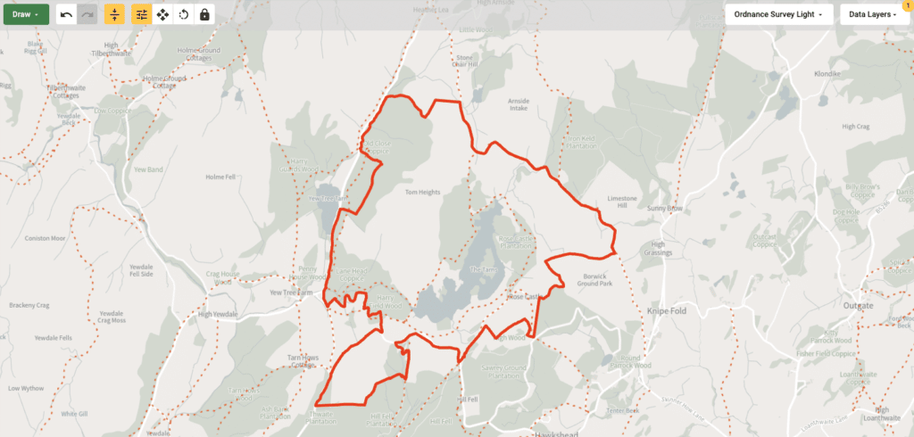
| Size: | 190.34 ha |
| District: | South Lakeland |
| Ownership: | National Trust |
| Condition Summary: | Favorable |
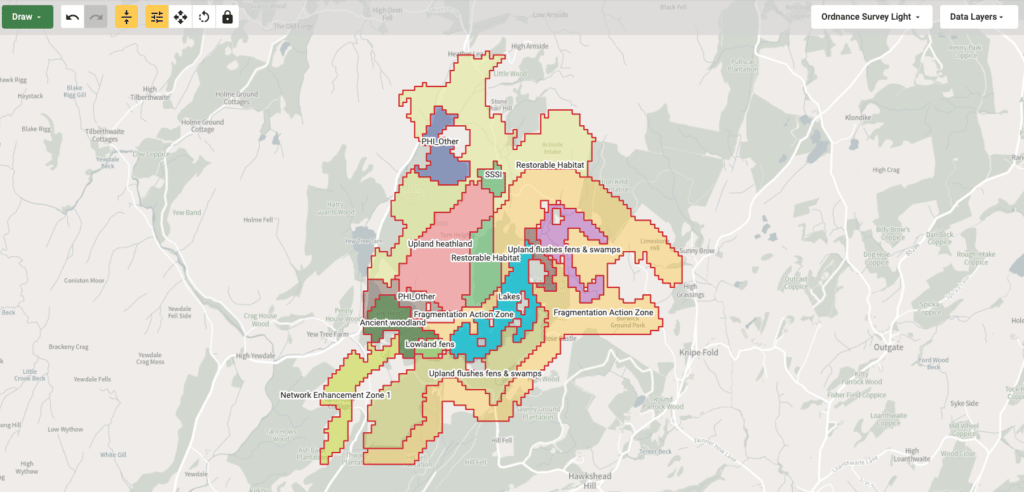
| Interest: | Biological |
| Main Habitats: | BROADLEAVED, MIXED AND YEW WOODLAND FEN, MARSH AND SWAMP IMPROVED GRASSLAND STANDING OPEN WATER AND CANALS |
A Biological Snapshot:
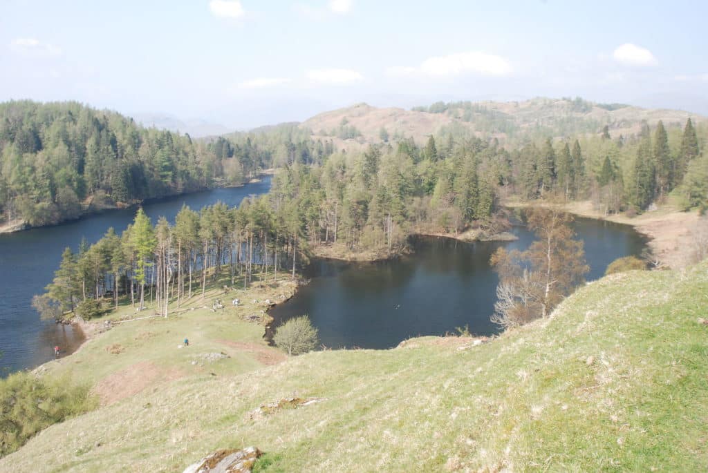
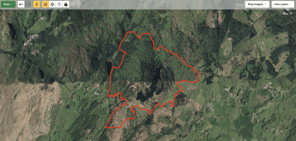
The Tarn Hows SSSI is situated on an area of fell 3km north-east of Coniston and 3km north-west of Hawkshead. It is the best known example of a tarn at the richer end of the meso-oligotrophic (nutrient poor) group of tarns and has a particularly diverse aquatic flora.
The rest of the Tarn’s catchment area consists of acid grassland, bracken and old larch plantations, with small areas of dry heath dominated by heather Calluna vulgaris on the rockier parts of Tom Heights. Below the southwest end of the Tarn lies a small area of fellside woodland comprising Harryfield Wood and Lane Head Coppice. This is of particular interest owing to its rich epiphytic lichen flora which is characteristic of ancient woodland.
One Man’s Vision:
Marshall’s Tarn Hows vision was one influenced by a surge of Romanticism taking place in the Lake District at the time. He wanted to create a site for the visual sublime. Marshall oversaw the planting of clumps of trees designed to highlight rocky knolls and the dramatic Lakes landscape beyond. To protect his new planting of broadleaf trees such as sycamore, beach, alder, cherry and willow, he also planted ‘nurse’ crops of conifers including larch and spruce.
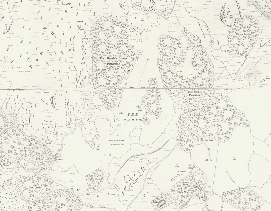
These care-taking conifers were intended to be removed once the young broadleaf trees were established. However, Marshall died before his vision was realised and the nurse crops were never removed. The larch and spruce trees then grew to dominate the Tarn Hows panorama as we know it today. Thanks to the National Library Scotland historical mapping records, we’re able to gain an early impression of how Tarn Hows looked in 1888.
Beatrix Potter:
In 1930 the Marshall family were ready to sell Tarn Hows. Coincidently, Beatrix Potter’s husband, Mr Heelis, was the solicitor for the Marshall family and therefore was informed of the sale. Aware of Beatrix Potter’s love of the tarns, described in her diaries as her ‘favourite walk’, Heelis negotiated to buy the whole estate for £15,000, relying on the National Trust to be able to appeal to the public to raise enough money for the purchase. It was during the time of Potter’s ownership over Tarn Hows that many of the public footpaths – now enjoyed by tourists and locals alike – were mapped and implemented. During the period when Potter and Heelis owned the whole estate it was successfully managed by the two of them and became a site of inspiration in many of Potter’s tales. The National Trust went on to buy most of the land back from Potter in the subsequent decade and the remaining land was donated to the National Trust by Potter anonymously.
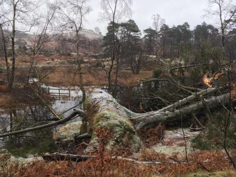
A Stormy Future and the Growing Need for Spatial Data:
In late November last year, Storm Arwen swept through the SSSI leading to two days of destruction. Rain, snow and high winds of nearly 100mph hit the Tarn. Almost a year later, fallen trees and debris are still blocking access roads and footpaths, making the area difficult to reach for restoration workers and unsafe for visitors. In light of an increasing frequency of extreme weather events, it is more crucial than ever that SSSI land managers are able to secure the funding they need to ensure that sites such as Tarn Hows can increase their resilience to climate change. A large part of this resilience-based approach will be played by spatial data insights, allowing governments and businesses to adopt policies and mitigate risk to protect high risk areas. Going forward, there will be an even greater need for the evidence and insights that location data can provide – you can only manage what you can measure. Governments and land managers need accurate, detailed information that people can trust, and this is what geospatial data offers – precise, reliable data that can be used to track climate change and monitor the impact of measures used to combat it.
Want the SSSI that you manage or own to feature in our series? Get in touch with us on support@thelandapp.com to share your SSSI story.
