
Today’s land managers, farmers, ecologists, land agents, and estate owners all walk through a far more complex terrain, one where fields must grow food and foster wildness, and actions must be shown and proven. Therefore, a plan confined to the office is only an idea; it is in the field, with boots on the ground, that its true value can be seen.
Land App Mobile was created to bridge that gap between strategy and reality, and already we’re hearing compelling stories from our users of the unique ways they are leveraging the app in the field.
For Shaun Dowman, Environmental Advisor with FWAG East, it’s about making on-site bird surveys quicker and turning raw data into compelling visualisations for his clients. For James Windridge, Farm Manager at Hampton Estate, the mobile app has been the essential link between a complex estate and his on-the-ground reality, helping him get up to speed when his role started. And for Anthony Barber-Lomax, Estate Director at Southill Estate, it’s about empowering his entire team to handle a wide range of tasks, from fly-tipping to deer culling, with a single, intuitive tool.
These are their stories.
Transforming Bird Surveys: Shaun from FWAG East
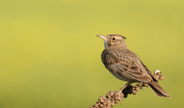
Paper maps, notebooks, and manual data transfer once defined the work of environmental advisors like Shaun. His team at FWAG East are often tasked with carrying out intricate breeding bird surveys using the British Trust for Ornithology methodology, a time-consuming process that involves manually recording data on paper maps in the field. This double entry was not only a drain on his team’s time, but it also created a lag between the work on the ground and the level of detail in final outputs for clients.
With Land App Mobile, Shaun’s team now records data directly from the field, eliminating the paper-based step entirely. They regularly use the app’s geo-referenced mapping features to accurately plot bird records. By viewing the distance bands plotted onto the landscape via the app, they can instantly define the boundaries established with the survey (0-25m, 25-100m, and 100m+).
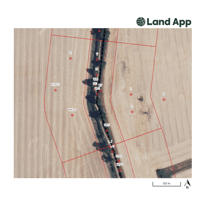
Additionally, surveyors are taking geo-located photos and notes and linking them directly to the farm’s digital map in real time. Back in the office, using the reports function, Shaun can easily extract this data into an Excel spreadsheet for more detailed analysis.
Ultimately, for Shaun and his team, the result is a massive leap in efficiency. They’ve cut out the time-consuming transfer stage, meaning they can complete surveys more quickly and deliver more value to clients. The biggest impact, however, is on the client themselves. Farmers and landowners now have direct access to their bird records in Land App. Being able to show clients their farm in a wider landscape context, with species overlaid, makes the data far more meaningful and engaging. As Shaun puts it:
“Land App Mobile makes surveys quicker to complete and turns results into something farmers can really see and use.”
The Digital Blueprint: James from Hampton Estate
When James Windridge took on the role of head of farming at Hampton Estate, he faced the immediate challenge of inheriting a long legacy of land management. Being “very new to Hampton and very new to Land App, having only been there six months”, he needed to get up to speed quickly.
Land App Mobile became his digital blueprint for getting familiar on the ground. And now the app remains a valuable tool for daily orientation and strategic planning. “It’s really handy for me that I can just pop onto my phone, have a look on the app, see which field I’m actually in, and see which fields are actually ours,” he explains. This simple act of verification, of ensuring he’s on “the right side of the fence,” is a fundamental part of his workflow.
He also uses the app’s drawing tools to plan and track everything from adaptive grazing paddocks to the specific fields for seed applications.
“where I’m doing adaptive grazing, multi-paddock grazing, I’m looking at splitting up the field so I can then, when I’m back in the office, make a note of how big the area was that I gave the cows”
The result is a workflow that is not just more efficient, but more strategic. James and his team now have all their information in a single source of truth, which means, as James puts it, they’re “not searching around for files, not having to email stuff across everywhere.”
Ultimately, the app empowers him to manage the farm’s complex operations with confidence, turning a siloed collection of maps and data into a single, living platform that helps to future-proof the entire estate.
A True Field Companion: Anthony from Southill Estate
For Anthony, Estate Director at Southill, he first discovered the app’s power in a surprising but excellent way when a fly-tipping incident occurred near a road on the estate. In the past, reporting such an event would have involved taking a photo on a separate device, attempting to note the approximate location, and then trying to explain it to the local authorities. Altogether, a cumbersome and often inaccurate process for a straightforward incident.
With Land App Mobile, he was able to instantly record and photograph the event. The app automatically captured the precise What3Words location, allowing him to report the incident with irrefutable evidence and pinpoint accuracy. Whilst being a novel example, this ability to capture and auto-sync an exact location, for whatever is happening on the farm, makes a huge difference.
“The beautiful thing about the mobile app is that it is with you all the time, and that it synchronises”
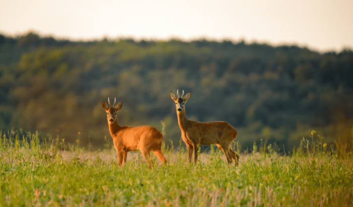
The value of this feature became clear in other areas of the estate as well. The estate’s game department uses the app’s geo-referencing to record the precise location of every deer carcass, creating an auditable record of their culling activities. And now, Anthony and his team are increasingly incorporating the app’s capabilities for data collection:
“We’ve got stewardship schemes. We’re recording stuff out in the field for those, if we’ve got issues with fence lines, utilities, we’re identifying stuff”
Ultimately, for Anthony, the app’s real value lies in its power to turn day-to-day tasks into quantifiable, valuable data. The app has become the necessary “proof engine,” allowing his team to capture real-world evidence and integrate it directly into the estate’s master plan.
The Key Benefits
The stories of Shaun, James, and Anthony, while unique in their purpose, all point to the same transformative benefits of Land App Mobile.
- Ease of Use: All three users, with minimal prior experience, found the app intuitive and easy to adopt.
- Flexibility: The app has supported each of them with a wide range of tasks, from environmental surveys and grazing planning to fly-tipping reports and deer culling, all without needing a specific template for each.
- Efficiency: The ability to collect data digitally in the field eliminates manual data entry, reduces errors, and saves time.
- Collaboration: The app serves as a single source of truth, allowing teams to share information and work together seamlessly, whether in the office or out in the field.
Ready to ground-truth your plans and unlock your land’s full potential? Land App Mobile is available with a Standard and Pro subscription, download today and join the growing number of land managers who are making the field their office.
