The Land App is an intuitive platform that meets all your mapping needs.
It’s specifically designed to help agents, advisors and land managers work effectively together. 45% of farmland in England has already been mapped on the platform by our customers.
"An invaluable tool in advising our clients for Countryside Stewardship, BPS schemes, valuations, land sales or assessing natural capital potential on
holdings. The Land App is now our go to mapping programme within
the Brooks Leney Team."
Chris Leney, Brooks LeneyFounding Partner
"The Land App is a core tool in our rural consultancy business. The drawing functionality and the abundant data layers we can use for our clients have proved invaluable. The Land App allows us to provide high definition plans, detailed advice quickly, all at a reasonable cost to the client."
Oliver Atkinson, BCMGraduate Rural Surveyor
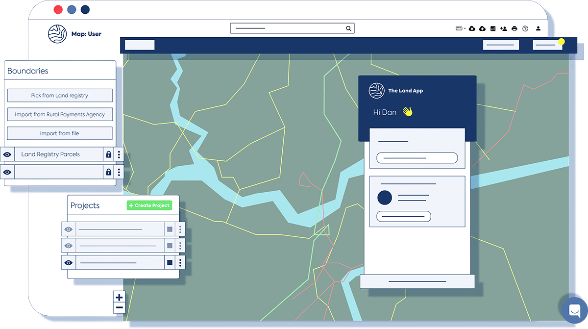
A master key to unlock your workflow
The Land App is a simple to use yet powerful mapping tool.
Save time working with clients
Revolutionise your current operations by connecting your team
Automate insightful calculations for schemes, valuations and reports
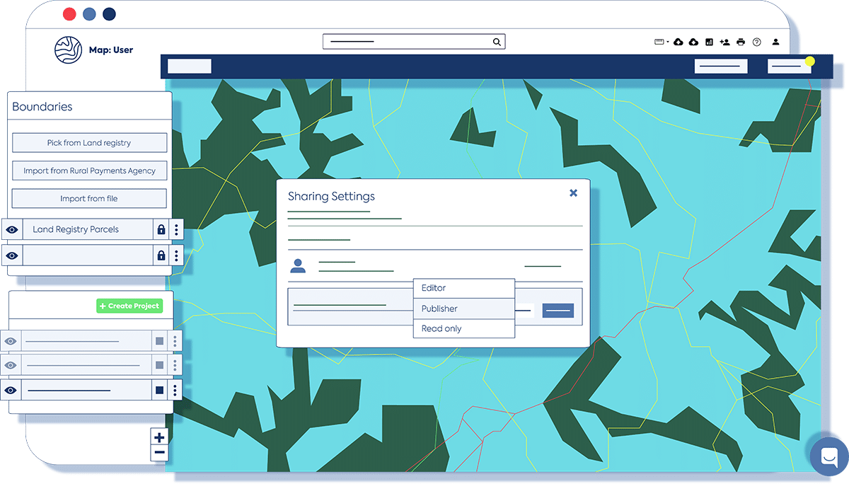
Build richer client relationships with easy to use dual collaboration settings
Boost collaboration across your whole organisation
Prepare to step into natural capital markets at the click of a button
Advise your clients equipped with the data you need
Plan smarter at any scale
Our interactive map uses fully formatted spatial data and enables you to quickly draw any map you need for your work. With live, instantly accessible information from OS, RPA and other official data providers, you’ll be able to baseline or design future projects with confidence.
Save time and boost productivity
The Land App brings together the key data you need, including Designations, Priority Habitats and Ordnance Survey MasterMap. You’ll be able to complete previously time-consuming tasks quickly and with a high degree of accuracy and reliability.
Take error out of the equation
By using our pre-defined templates and over 50 official data layers, including core data for BPS and Countryside Stewardship, you’ll reduce room for error and make compliance easy.
Get instant reports
In addition to the map view, all data is stored at the table view level. This can be organised by any data layer so you can quickly see and download the exact tabular information you need. It also makes it simple to submit RPA forms.
Collaborate live with colleagues and clients
Gather two people or a thousand to work digitally from a single source of truth. Our interactive map makes for rich client relationships and productive sessions without meeting in person.
Stay ahead and be notified of opportunities
Scope out everything from habitat networks to flood buffers, agroforestry to wildlife corridors, and from historic landfill sites to arable farmland, so you can assess how to move into natural capital markets.