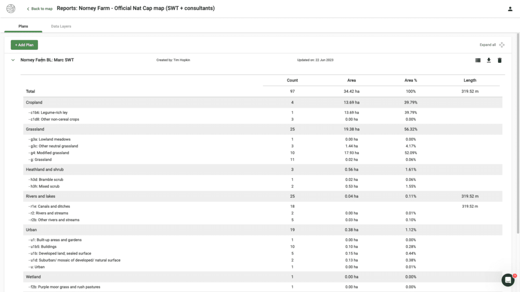
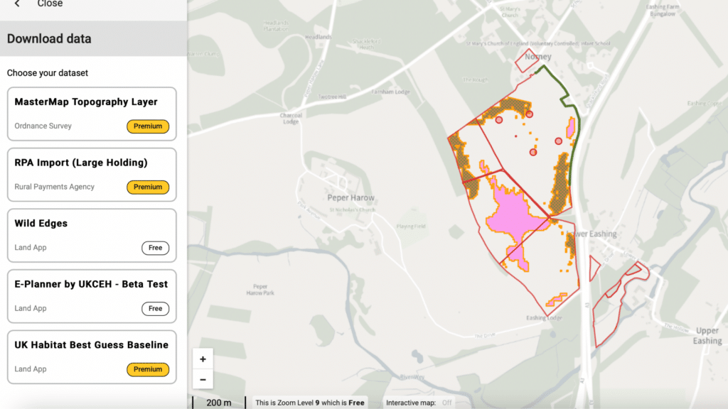
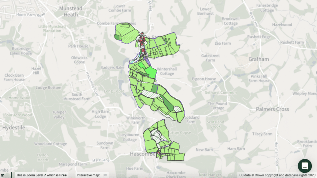
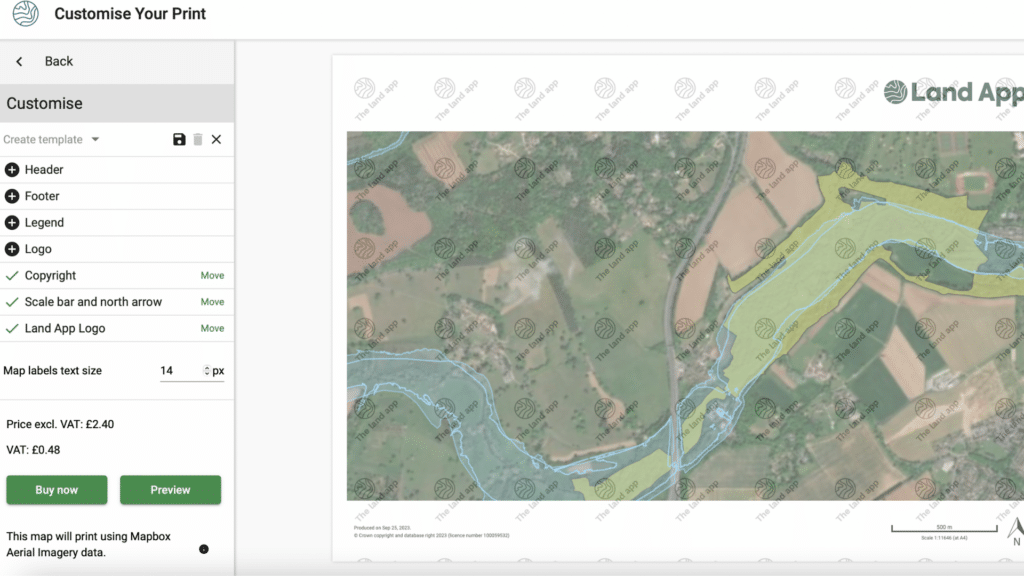
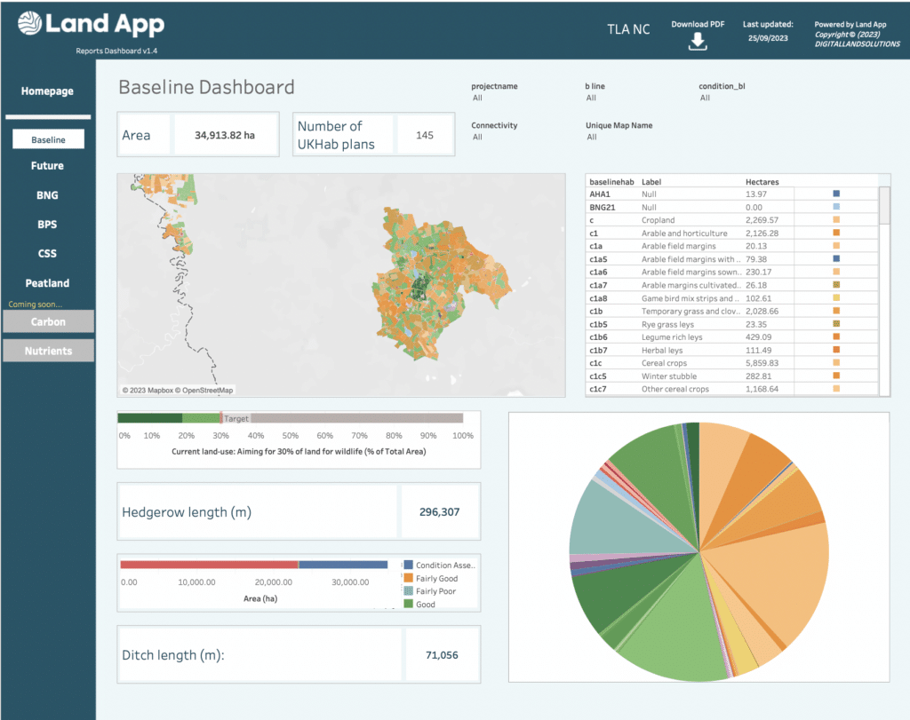
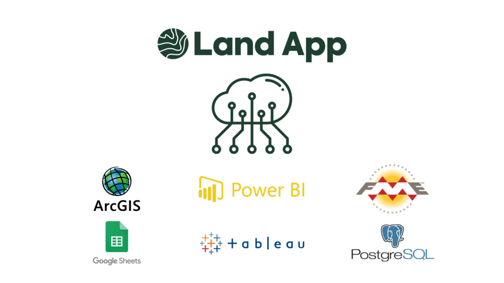
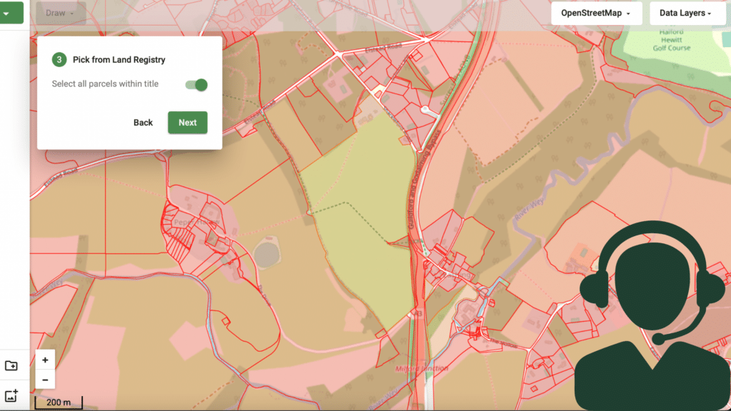
Functions
A suite of geospatial possibilities
You have free access to most of the Land App’s core mapping power. There’s no limit to the number of maps you can create or plans you can design. Pro-subscription gets you cohesive Team Management, access to OS Data Hub, Map of Maps and discounted printing. You can also pay as you go for printing and OS data transactional.
The data and tools you need
The Land App is a live, evolving platform with many more features to come. As of today, you can benefit from many functions, including:
- Drawing tools
- Authoritative data layers
- Project templates
- Instant reports
- Map of Maps
- Printing
Free functions
The Land App is designed to resource some of the best work being done in Britain to create a sustainable financial future for our land, so we choose to offer most of our functionality free of charge.
Drawing tools
Create and customise your own maps to plan for present and future scenarios:
- Switch between aerial imagery and other base maps
- Use Land Registry or RPA field boundaries to see the boundaries of your land
- Merge and split fields
- Draw buffers, hedges, ponds and more
- Annotate with text, arrows and T-marks
Authoritative data layers
Put an area into context by overlaying your choice of over 65 authoritative and free data sets.
- Land Registry titles
- Statutory designations
- Priority habitat networks
- Authority boundaries
- Environmental schemes
- Flood zone areas
- Utilities and water
- Public rights of way and other access
- Heritage data
Project templates
Use pre-populated templates from our library to map out projects, design multiple scenarios, and prepare for official subsidy applications with ease.
- Basic Payment Scheme
- Countryside stewardship
- Environmental stewardship
- Baseline habitat assessment
- Land management plan
- Ownership boundary
- Land registration (FR1)
- Sales plan
- Valuation plan
- RLE1 form
- Field risk map
Printing
Printed maps at the click of a button.
- Free printing with OpenStreetMaps
- Download prints as PDF, JPEG or PNG
Instant reports
Get a summary of crucial data so that you can quickly identify:
- Context and priorities
- Landscape designations
- Conservation constraints
- Future opportunities
A data-secure way to work digitally
- Own your data
- Cloud-based access
- Live team collaboration
- Data encryption protection
Premium functions
Our free-of-charge feature list is longer than most, but in order to keep developing the Land App as a valuable resource, we offer the following premium features to Pro users only.
Premium data layers & printing
Purchase highly detailed OS MasterMap data layers to prepare for natural capital markets, biodiversity offsetting and site discovery.
- Print authoritative OS data for official applications.
Integration API and Bespoke Dashboards
Premium users can export live data from their organisational account to external third-party databases through our Integration API.
- Run data to third-party apps off Land App generated content.
- Seamlessly share data with other software.
- Develop own data workflows and dashboards
Map of Maps
Throw aside traditional static mapping methods and enter into intuitive, cloud-based, live collaboration that’s effective at any scale:
- Collaborate in real-time on baseline assessments and other projects
- Prevent confusion and collaborative breakdown
- Ensure you and your team are working from a single source of accurate truth
- Build Land Management Plans for a single holding or an entire community
- Invite advisors to edit and publish your baseline and Land Management Plans
- Reimagine a new future for the landscape and access natural capital markets