
This month, I want to talk about that vital link between the land and the screen, with the simple act of ground truthing. Collecting data when you’re in the field is arguably the most important step in the entire land management process. It’s the moment when the “best guess” on a map becomes the verified evidence needed to unlock funding. Because without it, the rest is just theory.
The Imperative of a Verified Baseline
For any successful transaction to happen in the land sector – for land managers to get funded, for trades to occur, or for investment to flow – you need the one non-negotiable component of a verified baseline. We are incredibly fortunate in Britain that we have a wealth of data from sources like the OS and RPA, which allows us to provide a relatively cost-effective initial assessment of a parcel of land. That’s undoubtedly a great start, but we have to remember that this data, however good, is only ever a best guess. It’s the latest assessment of the land, not a verified reality.
The crucial precondition for securing any funding, be it an agri-environmental agreement or a complex Biodiversity Net Gain (BNG) trade, is to move beyond that ‘best guess’ and verify the baseline. In the past, this has often meant cumbersome paperwork, trails of photos, and time-consuming site visits. But now a dedicated mobile tool, like what we’ve developed with Land App Mobile, is becoming essential. It takes all that raw, best-guess data and makes it interactive in your pocket, allowing you to capture georeferenced evidence and make real-time edits right in the field.
This capability is what allows land managers to quickly and cost-effectively get a farm or estate market-ready. We see this in two main phases:
The first is baselines and compliance. For simple schemes like SFI or Countryside Stewardship, the mobile app streamlines the initial steps, such as quickly correcting field boundaries, updating land cover, and capturing early evidence. For more complex projects like BNG, it allows an ecologist or trained professional to make real-time, nuanced edits to the baseline. All that captured data is instantly available on the web app, allowing an adviser to start designing the future state of the land on a foundation of verified facts.
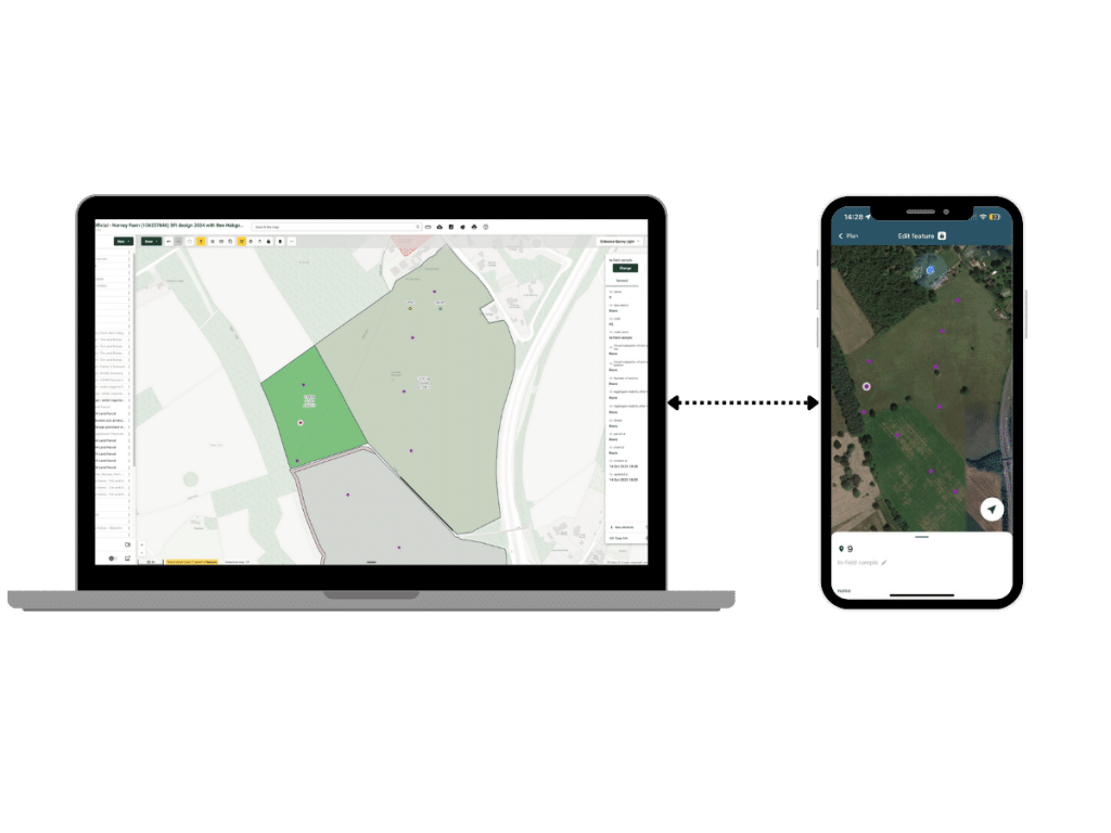
The second phase is Monitoring, Reporting, and Verification (MRV). Once a project is funded, the mobile app acts as the compliance officer in your pocket. As I headed out one evening earlier this month for SFI soil sampling, I used the app to map the exact sample locations and log the data (see image below). This provides a live, georeferenced record of the contract’s delivery. And ultimately, this dramatically reduces the burden of MRV on the land manager while giving funders the confidence that their money is going where it should.
Policy and Private Finance
Let’s consider blended finance for a moment. The private sector, which provides supplementary funding, has a much more pressing demand for a verifiable return on investment (ROI). They need to know, with confidence, that the money they provided actually went to planting trees, improving soil quality, or slowing the flow of water. That confidence is impossible without rigorous ground truthing.
The same level of stringency should apply to government schemes. Defra needs that same quality of validation and verification to ensure taxpayer money is deployed effectively to deliver national outcomes. This data capture is fundamental for the whole market to work with integrity. Whether it’s a food retailer investing in a local catchment or an international organisation funding climate resilience in another country’s food production, this quality of on-the-ground data is the prerequisite for unlocking sustainable, long-term capital globally.
A Tool That Grows With You
It’s amazing to reflect on how far we’ve come already. When we first launched Land App Mobile, it was incredibly simple – essentially a mechanism to capture a georeferenced photo and make it visible on the web app. Now, it’s totally interoperable and dramatically more powerful. We built in offline mode, real-time syncing, templated surveys for complexity like hedge sampling, and the ability to download any plan from the web to stake out features right in the field. This evolution means that the app’s flexibility is huge. From marking where fly-tipping has occurred and recording a padlock code, to the essential work of mapping soil sample locations for an SFI soil management and nutrient plan, I’m continually reminded of the unique ways our users are utilising it.
Despite this broader capability, our number one priority is to ensure the app serves the land manager without ever becoming a burden. We are keenly focused on making sure it’s a tool for simplification, not complexity. I therefore encourage you to reach out to us with any ideas, feedback, or recommendations you may have, so we may collectively refine this evolving tool.
Tim Hopkin
