
Land App hosts a suite of features designed to help design, plan and manage regenerative farming. From appraising habitat enhancement, using our data layers to plan interventions, to drawing your bespoke rotational grazing plan, our software has it covered. Here are our top six (of many!) features to speed up your regenerative planning:
New to regenerative farming? Learn more in our blog
Wild Edges – Suggestions to widen your hedgerows and field margins
One of the key elements of regenerative agriculture is to restore biodiversity, and one of the best ways to do this is to improve hedgerow and management, field margins and habitat connectivity. Wild Edges offers automated suggestions based on key habitat datasets to highlight where these interventions could be made on your land, which can then be selected if suitable and incorporated into a future land management plan.
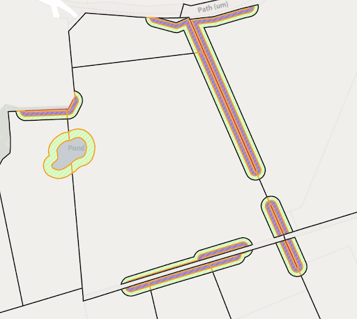
Wild Edges Tool
LiDAR and Floodzone data layers – Water-flow data to inform potential wetland management
Retaining water in the landscape is critical for managing resource use, soil health, drought resilience and reducing the risk of flooding. Many regenerative agriculture practitioners focus on better water management and data layers are an excellent feature to help with this. Using key water flow data sets, including LIDAR, users can assess where in the landscape water is likely to accumulate, and highlights where might be ideal for placing a water management intervention, such as a pond, scrape or ditch. To learn more about how Wetlands work in the farmed environment, read our case study with FarmED here.
Connectivity Scorer – Habitat connectivity calculator to join up landscapes
Habitat connectivity is key to biodiversity and species migration, as set out by the Making Space for Nature report. Our specialist calculator assesses your land boundary to calculate how ‘joined up’ your habitats and hedgerows are. Planning interventions, even planting or joining a hedgerow or two, can massively improve your ‘score’, all of which can be built into your land management plan thanks to the bespoke connectivity scorer.
EWCO Template – Appraise woodland management opportunities
Regenerative land management has a focus on restoring soils and sequestering carbon. Management of this can involve committing some areas of land to woodland (at varying scales), agroforestry, silvopasture and so on. Our bespoke EWCO template, developed in partnership with the Forestry Commission, highlights where might be eligible for tree planting or “stackable options” to increase funding for woodland management. By taking the areas that make the most sense ecologically and financially for your land, and developing this into a future plan, our EWCO Checker is an excellent tool in your regenerative mapping toolbox.
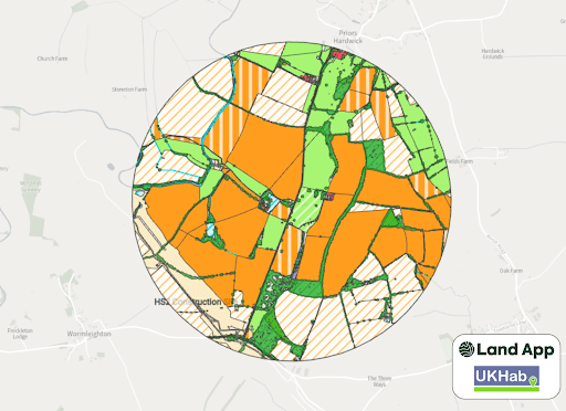
UK Habitat Best-Guess Baseline – Accurately display your land use and biodiversity baseline
Cutting edge and invaluable for Biodiversity Net Gain assessments, our Best Guess Baseline delivers an accurate digital map of your land holding in UK Habitat Classification data, meaning a biodiversity unit score for your land can be generated automatically. Enhancing biodiversity – and getting funding for it – is critical for regenerative practices, and BNG is an avenue many will explore as they transition to more regenerative methods.
Land Management Plan – An interactive digital map to plan your holistic grazing
Managing grazing is core to regenerative methods of farming – rotating livestock to distribute nutrients, improve soil health, and fertilise crop fields is a widely adopted approach. Planning these rotations, especially at scale, can be a headache. Land App’s suite of mapping and drawing tools enables you to build layered, detailed plans of where and when to move your livestock, ensuring regenerative livestock management is built into the heart of your farm.
The list by no means ends there. Land App offers a broad range of functions, some available at different tiers, which are a huge help in planning a regenerative approach to land management. You can see the functions list here.
