
Previously led by Alison Field – former Director in the South East for the Forestry Commission – the project is now under the watch of Matthew Norris-Hill (of FWAG South-East). The project has a wide scope; from integrating agroecological principles into farming (using CS grants), restoring and improving highly distinctive chalk stream catchments, and forestry management for improved woodland health. Here, we discuss with Alison the success of the facilitation fund so far, and how Land App has proved an invaluable tool for landscape recovery…
Objectives
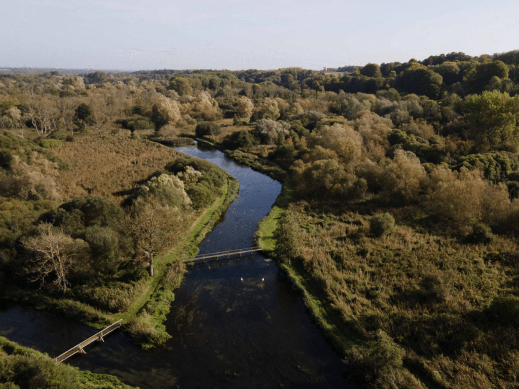
At the outset, the project set out to respond to the priorities in the national character area assessments by Natural England in 2015. Of particular focus here was the national character area of the mid-Hampshire downs; of which the key restoration drivers are protecting ancient woodland, improving biodiversity in the farmed landscape, and restoring chalk grassland. Moreover, the cluster spans a significant part of the River Test, whose catchment is home to iconic chalk streams which are rare habitats of not only national, but international significance.
Not only does this require collaborative and sophisticated planning at the landscape scale to connect Stewardship options for maximum impact, but three specific major projects are also being carried out.
- River restoration for wild fish: The group is working with the Wessex Rivers Trust, The Piscatorial Society and The Test & Itchen Association on several projects aimed to improve the ecological status of the rivers. In particular, this hopes to restore quality habitat to allow the recovery of wild fish populations.
- Improving water quality with Southern Water: Southern Water, like many other water companies, want to support more habitat improvement work, in this instance to improve the quality of chalk water systems. This has resulted in a nitrate reduction project across multiple clusters (of which Winchester is one). Over the last two years, this has seen around a 1000 hectares being sown as cover crops, resulting in £40,000 of private sector funding being paid directly to farmers. This provides multiple benefits: not only improving soil quality and reducing run off/soil erosion by remaining covered throughout winters, but also sees flocks of birds on the cover crops.
- Ash management with Forestry Commission: Four farmers within the cluster are working together on a joint contract to remove dying ash on a 4 mile stretch of main road which intersects the cluster. Whilst this would have initially represented a high cost to the landowners, managing it through a the facilitation group has enabled the cost to be shared, and for a £40,000 grant under the Forestry Commission’s tree health pilot scheme to be accessed to support the initial planning and management, as well as the cost of replanting.
“Our vision is for a connected landscape where nature thrives and we are surrounded by nature on our farms.”
So, how can 40 cluster members across 40,000 acres be managed? Though baseline surveys needed to be carried out and individual key performance indicators (KPIs) for biodiversity uplift assigned, there remains the challenge of implementation. How do you transition from a theoretical aim, to translating this into day-to-day action for a farmer’s work?
A key part of this, Alison tells us, is “giving the farmers the knowledge and the access to knowledge so that they can tell their own story”. Land App played a crucial role here. Data was edited, uploaded into the Land App and then shared, so that each member had unique access just to the maps and data layers relevant to their farms. Farmer input to check the accuracy of the UK Habitat map layers created invaluable insight and helped to develop a far more detailed survey of the landscape. By having a sophisticated and collaborative mapping software to design at scale, rapid progress has been made on aligning environmental actions, such as connecting margins and pollinator strips. By providing a platform by which the cluster can communicate plans in real time, Land App is thrilled to have played a part in helping the cluster reach an impressive 28% of the area managed by farmers in a way that benefits wildlife or the wider environment.
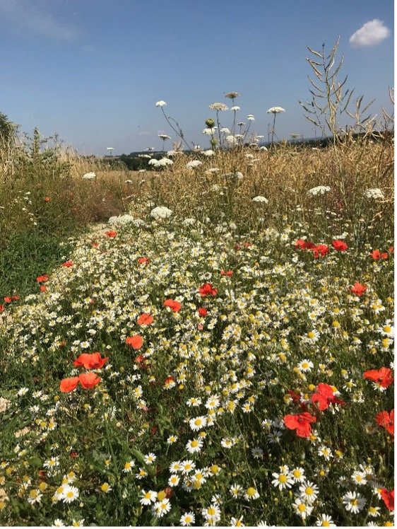
Wildflower Margin © Winchester to River Test Farming Cluster
“If you want to empower people to take responsibility for their actions, giving them the knowledge and information in a way they can access and understand means they can tell the story for other people”
How Land App helps
Asked why Land App was the software of choice for the project, Alison explained how, initially, there was no collaborative platform that empowered farmers and facilitators to work together. Having mapped multiple holdings with QGIS, this only captured a single point in time for baselines and project progress, with “no way of delivering this into the hands of the farmer as their tool, to use independently for their land’s data and update as their own resource”. By contrast, Land App “allows baseline data to be collected and entered, transferred to farmers and used by the farmers as their tool”. Crucially, Land App’s tailored template for Countryside Stewardship (CS) proved invaluable. Given it is designed to readily prepare and appraise grant applications – and CS is a farmer’s first port of call to finance delivery on the ground – it meant the facilitator could provide the participating farmers with the baseline maps for future grant schemes in a way that simply couldn’t be done with any other digital systems.
“Land App has a window in which it can pioneer – it can provide the farmer with the tools to manage the conservation resource on their farm with their neighbours at the landscape scale”
A model for Landscape Recovery
The Winchester to River Test Farm Cluster, and its mapping, provides an exemplary model for a successful landscape recovery project. Clearly, by ensuring that each individual within the group can not only be empowered to make individual change to improve the environment, but coordinate these efforts, means the environmental benefits can be maximised. As stewardship options are put into place, habitat corridors are formed or widened, and highly distinctive habitats and catchments are restored, the cluster will only continue to grow as an example of the benefits of landscape recovery for both farming and nature. In the words of Alison, the project shows“irrefutable evidence of change”. We are proud to continue to support them on their journey to restore nature.
Looking to use Land App for your own Landscape Recovery or natural capital project? Get in touch with the team today at sales@thelandapp.com.
You can learn more about the Winchester to River Test Farm Cluster by visiting their website here.
Cover image © Winchester to River Test Farming Cluster
