
Initial Site Analysis
Upon receiving an initial enquiry from a client, Chris’ first port of call for site identification is Land App. “While on the phone, we are able to identify the site in question via the postcode and address search functionality”.
After creating a new map for the client, Chris designs a new plan that outlines the ownership boundary of the property in question— this is made simple through Land App’s Land Registry data selection tool. Once the correct boundary of the property is known, a desktop exercise can be undertaken by switching on the relevant Data Layers from the Library to identify any factors that could affect the chances of gaining planning onsite, such as restrictive designations including Areas of Outstanding Natural Beauty or Flood Risk.
This initial information, sourced and created on Land App, is then taken along to the initial site meeting. “These visual maps help to inform discussions about the viability of the client’s proposed development. At this stage, assuming that the client’s proposal is in line with the development plan, the drafting of the application can begin!”
Supporting Planning Documents
The documentation requirements of planning applications can vary and it is always worth checking the “validation checklist” for your designated council. However, the requirement for a location and block plan to support your application is largely consistent nationwide.
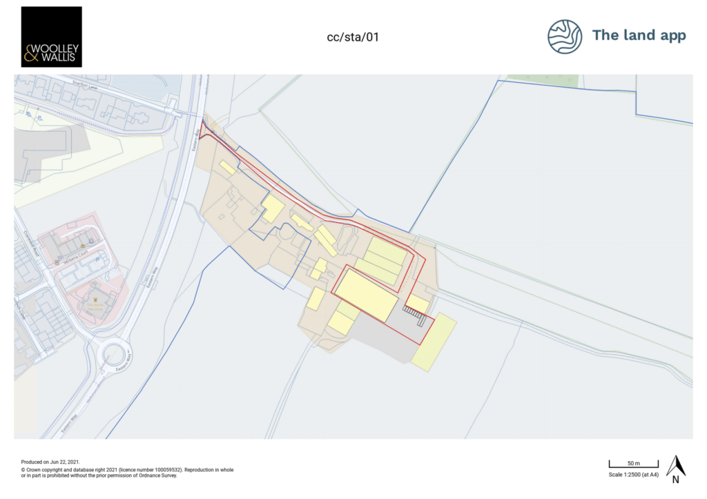
Location Plans
Having already imported the Land Registry data onto the client’s map, a duplicate plan is then created and named “Location Plan”. This is easy to achieve through Land App’s plan duplication feature.
Within the Location Plan, Chris uses Land App’s intuitive ‘MasterMap Topography’ Data Layer to copy across the relevant features into his plan to create a red line boundary representing the development area in question.
The red line boundary is also supplemented with a blue line boundary, which delineates any other land within the same ownership that sits outside the development area. Both blue and red boundary lines can be styled, coloured and adjusted on Land App to suit the preferences of the individual surveyor.
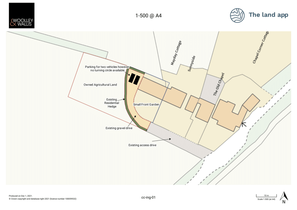
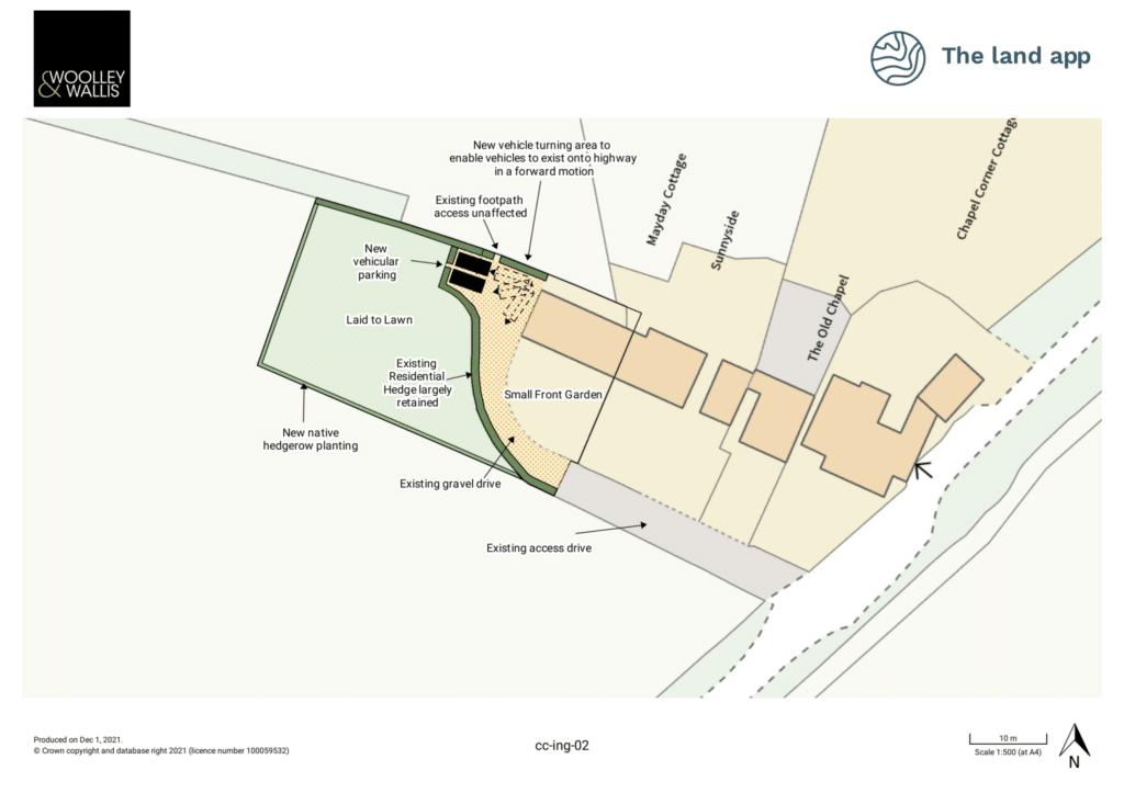
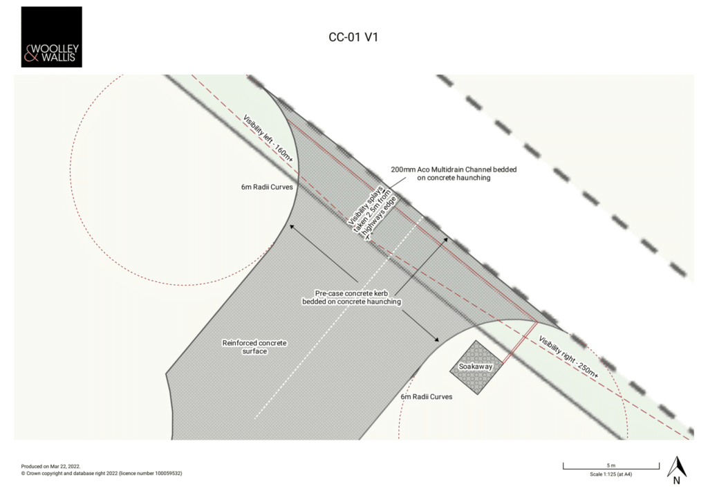
Block Plans
Chris then uses the Land App platform to create a Block Plan, used to show the specific details of the proposal. Chris notes that “before and after’s can be a really useful tool to fully explain what you’re trying to achieve, this is really easy to demonstrate on Land App by switching between your plans”. At this stage, Chris will also take advantage of Land App’s arrow and text point tools, enabling a more concrete explanation of the proposal to the planning officer and consultees when they come to review the maps themselves.
Outlined below is an example of a ‘before and after’ Block Plan:
Before:
After:
Additional Plans to Support Applications
Chris goes on to explain that sometimes Location and Block Plans do not show enough detail on a certain area. In this case Chris uses Land App to create further Detailed Plans at a lower ratio scale. Ratio scales can also be easily adjusted during the print process on the Land App platform, enabling the creation of a tailored map for specific project needs. An example is showcased below:
Landscape Plans
Chris explains that “depending on the application a landscaping plan may be required demonstrating how we are planning to mitigate the impacts of the development”.
By January 2024, “Mandatory BNG” (Biodiversity Net Gain) for all planning applications will be a legal requirement. Here, it is expected that all new development sites will implement at least a 10% uplift in Biodiversity, either on-site or off-site. Chris notes how important the process of environmental uplift across new development sites is; “making sure all proposals align with the local environment is crucial during our application process”. Below is an example of how Chris has been using Land App to design environmentally sensitive Landscape Plans:
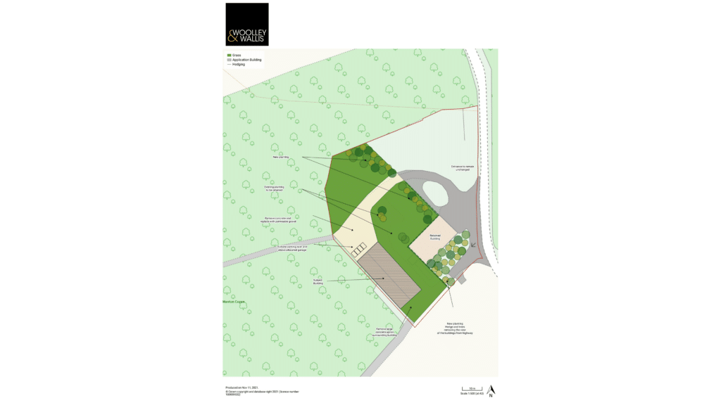
Chris also notes that the Land App’s ability to automatically create a legend when printing out Block Plans can be “a useful tool to draw attention to certain aspects of the proposal”, as shown in the example above. Legends can also be edited during the printing process for bespoke feature identification.
As Chris highlights, Land App provides value across a wide array of company needs. From the intuitive mapping functions, to our highly specific and wide-ranging datasets, efficient planning and valuation is one of the core benefits of the software.
Interested in taking your business to the next level like Woolley & Wallis?
Sign up for a free account, or get in touch with sales at sales@thelandapp.com
