
Groundswell 2024: 5 Key Takeaways from the Land App Team
Groundswell Festival 2024 was a remarkable meet of people passionate about regenerative agriculture, and excited about what the future for farming holds.

Groundswell Festival 2024 was a remarkable meet of people passionate about regenerative agriculture, and excited about what the future for farming holds.

Each month, the team at Defra send us their updates, and we’ll share the top picks which we believe are important and helpful for you, our community of Land App users, here on the blog.
As more and more people turn to digital mapping to support their land management, staying up to date with Land App’s features is one of the best ways to ensure success.
Each month, the team at Defra send us their updates, and we’ll share the top picks which we believe are important and helpful for you, our community of Land App users, here on the blog.
As we enter the second year of our project with Sainsbury’s, we reflect on our journey and the progress we’ve made towards a more resilient food-producing landscape.
This month, we’re introducing our new blog series “Updates from Defra”. Each month, the team at Defra send us their updates, and we’ll share the top picks which we believe are important and helpful for you, our community of Land App users, here on the blog.
Recently, we announced our partnership with UKHab Ltd, helping to bring efficiency, consistency, and accuracy to the way habitat assessments are carried out.
The UK Habitat Classification system (also referred to as UKHab) is a coding system used for surveying and classifying habitats when conducting a habitat assessment. By assigning specific ecological features a primary habitat code, secondary code, and condition score, it enables ecosystems to be mapped with accuracy and detail.

Biodiversity Net Gain (BNG) is a central policy for both development and conservation in England, introducing a new focus to the way we approach land development. This blog explores what BNG is: its key points, purpose, and why it matters to various stakeholders.
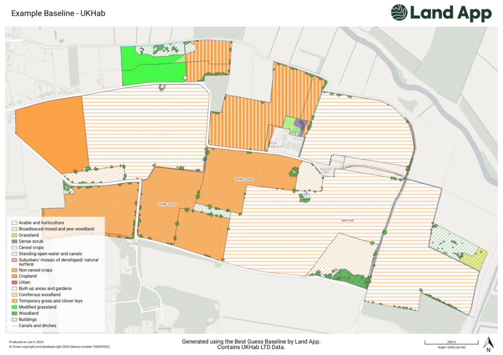
We’re pleased to share that our Professional subscribers now receive 30% off UK Habitat Best Guess Baseline data.