

It is now in its second version (“UKHab V2”) and plays an increasingly important role in the work of ecologists for habitat surveys, development projects, and Biodiversity Net Gain. As its use grows, more and more of our users are looking to learn more. Read on for a back-to-basics overview of the UK Habitat Classification System and how it works…
Why is UKHab Needed?
The UK Habitat Classification was written, and is monitored by, the team at UKHab Ltd. Consisting of professional ecologists with a wealth of experience, they introduced the classification to address the following:
- Inconsistencies between habitat and vegetation classifications
- Achieve consistency within and across surveys
- Allow Natural England, Scottish Natural Heritage, Natural Resources Wales, Department of the Environment Northern Ireland, and JNCC to report consistently on habitats of European and national significance.
- Provide uniform habitat and contextual data for Environmental and Social Impact Assessments, the application of the Mitigation Hierarchy, planning for Biodiversity Net Gain, and detailed Green Infrastructure plans.
- Achieve a unified system for new recording that would translate to as many of the existing systems and heritage data as possible.

How does the classification work?
There are two editions of the UKHab system – the Basic Edition and the Professional Edition, the latter being fully comprehensive. It has been designed to be flexible – you can use it just as easily for a small “walkover” survey as you can for regional and national scale habitat mapping – this usability helps to achieve consistency of habitat mapping. Accordingly, it integrates with the major classifications used across Europe and the UK.
The classification has been likened to a ‘hierarchy’ or a ‘pyramid’, covering terrestrial, freshwater, and marine habitats. “Codes” are split into “primary” and “secondary” – the former determines the primary habitat type, and the second adds further detail and context. The classification consists of five levels:
- Level 1: Major Ecosystems: terrestrial, freshwater, or marine.
- Level 2: Ecosystem: nine ecosystem types, based upon the Mapping and Assessment of Ecosystems and their Services (MAES) typology and corresponding with major habitat types within the EUNIS classification.
- Level 3: Broad Habitats: 20 broad habitat types, corresponding directly with UK Biodiversity Action Plan Broad Habitats and closely to EUNIS.
- Level 4: 85 habitats, including 46 UK Biodiversity Action Plan Priority Habitats, and further splits of Level 3 habitats.
- Level 5+: 119 habitats, including 72 from the EU Habitats Directive Annex I habitats, and further splits of Level 4 habitats.
“The combination of primary habitats and secondary codes is a major strength of the system, allowing habitat mosaics, habitat management, origins and other environmental and species features to be added directly to each coded primary habitat. This removes the need for complex target notes and substantially increases consistency and spatial accuracy of recording important features by attaching secondary codes directly to habitat polygons or linear features.”
– UKHab Ltd.
To find out more about the habitat classification, head to the UKHab Ltd. website for a detailed breakdown, here.
UK Habitat Classification System in Action
When mapping habitats, 100% of the mapping area should be given a primary habitat code, with secondary codes and condition scores optional depending on your use case. The recommended “Minimum Mapping Unit (MMU)” (size of the smallest features that should be allocated primary habitat code) is 5 m², however, this can be scaled based on your needs. Any features smaller than the MMU can be allocated as a secondary code instead (e.g. a small patch of scrub in a grassland, smaller than 5m², can be allocated as secondary code “10 – scattered scrub” rather than drawing each scrub fragment).
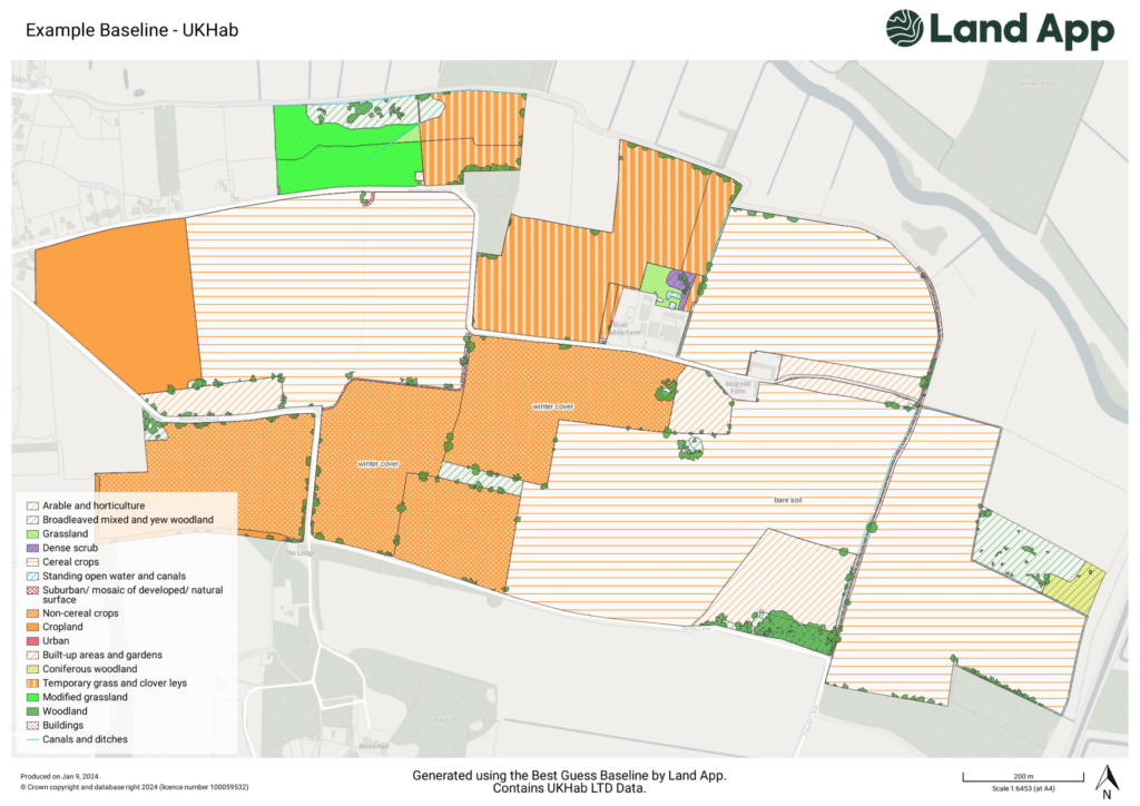
UK Habitat Classification System in Land App
At Land App, we have partnered with UKHab Ltd. to integrate the UK Habitat classification into our software. Both Professional and Basic editions are available in Land App as “Baseline Habitat Assessment” (a.k.a the current state) or “Land Management Plan” (a.k.a the future state). As a result, users can conduct a habitat assessment with precision, efficiency, and detail. Given how many land managers and ecologists use Land App, we’re helping to bring efficiency and consistency to the way habitat assessments are carried out across the sector.
