
Finding the Baseline
Like many other landowners across the country, Albanwise is in the process of navigating the agricultural transition. With new funding schemes and emerging natural capital markets starting to take shape, understanding current land use with the ability to design future scenarios is becoming increasingly valuable in identifying opportunities going forward. Any natural capital project must begin with a baseline; a natural capital audit which outlines the present state of land use and its impact on biodiversity, soil health, carbon sequestration and so forth. These surveys require precision and accuracy, not only for the benefit of maximising ecological recovery or improvement, but because they represent the data that will underpin natural capital trades.
The problem? Baselining is expensive, especially at scale. That’s where Land App’s “UKHab Best-Guess Baseline” (in partnership with UKHab LTD) comes in. By combining the latest land use data, satellite imagery and machine learning, the software can produce a habitat baseline assessment in the language of UKHab which in turn, when run through our Biodiversity Net Gain calculator dashboard, can provide an accurate estimate of existing Biodiversity Units. Essentially, Albanwise have been able to create an approximate digital twin of their land’s biodiversity value right across the estate – all in a matter of minutes. In turn, this allows key areas for improvement to be identified. Asked about the benefits this brings, Mike stressed this is an efficient way of looking at options; “We’ve had our objective of understanding baseline natural capital for some time, but couldn’t find a cost effective way of achieving this across 10,500 hectares – having an ecologist produce a UKHab survey would be seriously expensive”. The best guess baseline offers an alternative; it “could get us a long way there for a pretty good price”. Both Angus and Mike agreed the Land App offers a good starting point for a preliminary BNG assessment. Importantly, this is not a replacement for an ecologist – we advocate an ecologist verifying baselines that are made using the Best-Guess Baseline tool.
“The best guess baseline enables us to quickly assess the current biodiversity value across the landholding, enabling us to demonstrate the increased biodiversity value from our implementation of existing ELM schemes to meet company objectives.” – Angus Wells
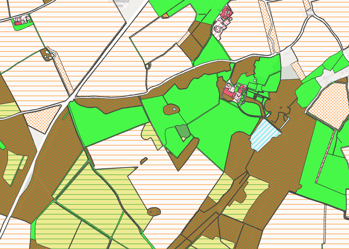
A screenshot section of the “Best Guess Baseline for the Albanwise Estate. © UKHAB LTD, under license. No onward license implied or provided. All rights reserved https://ukhab.org/commercial-eula/
Mapping the future
Combined with the ability to map and design future land use scenarios, the BNG calculator means users can gain a clear indication of which designs might have the biggest impact, whether this is simply improving an area’s condition score, or creating/restoring areas of habitat. As a result, opportunities can not only be identified, but confirmed as worth pursuing. Here, the efficiency and transferable use of digital mapping really comes to the fore. Angus praised how Land App allows for making a map for Countryside Stewardship, before reprocessing for farming plans, condition scores and back into a BNG plan. He claims this is “much more powerful” than siloed project planning (and analogue mapping), whilst its efficient workflows save substantial amounts of time.
“Creating our ELM applications by mapping on Land App as a starting point allows the data to be kept updated throughout the scheme and flow through into other projects as required. The data is re-processed into farming plans, claim forms, condition scores, as well as for feeding into natural capital baselines. This is then a powerful tool for having the information ‘at your fingertips’ – improving environmental outcomes & accuracy, and saving time.” – Angus Wells
Spatial prioritisation – using Land App as land use framework decision tool
As with any estate, Albanwise has various priorities which it needs to manage, and ensuring these land-use demands don’t overlap or compete is essential to successful management over the long term. Not only are there management considerations for agricultural land, but the business also manages development and renewable energy opportunities. Ensuring that these efforts are coordinated to maximise opportunity (both financially and for the environment) rather than compete with each other is essential. By spatially planning these contrasting elements, Albanwise can ensure it meets its own internal requirements, as well as complying with the demands of the landscape more broadly. By making the most of map layers, they can unlock the benefits of spatial and strategic land use planning – such as ensuring a woodland creation scheme does not compete with a housing development. When multiple teams are working across such a large land area, having the degree of clarity provided by Land App is essential.
Want to learn more about taking your estate’s natural capital strategy to the next level? Email the team at sales@thelandapp.com
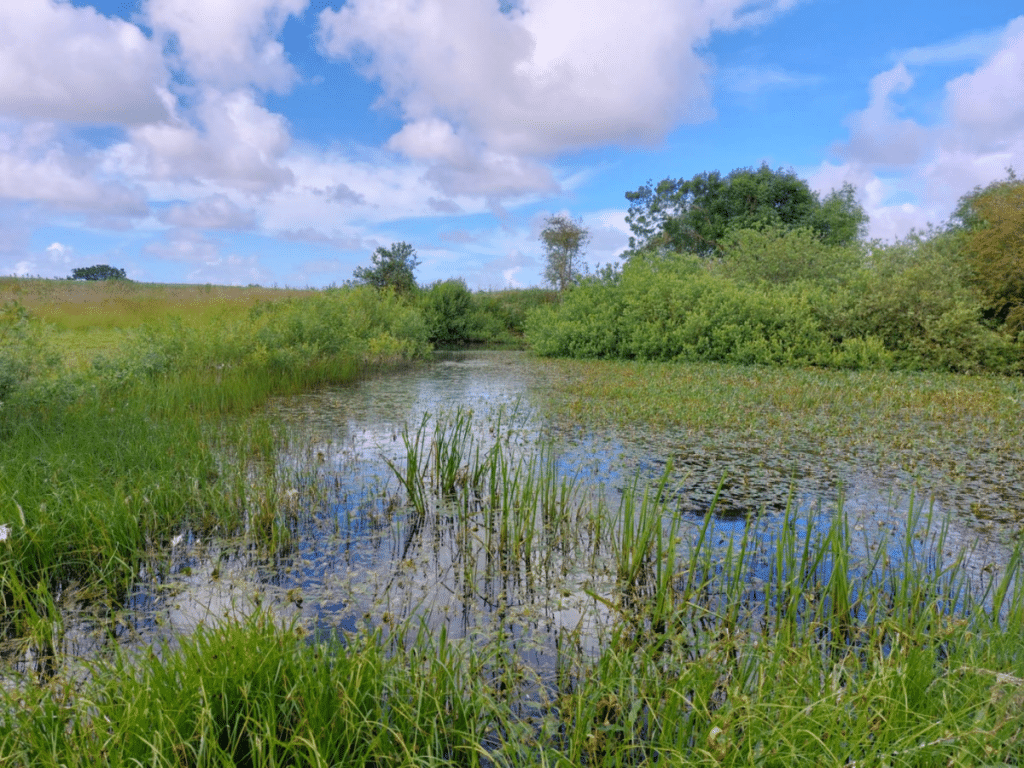
*Header photo: © 2023 Albanwise Environment
